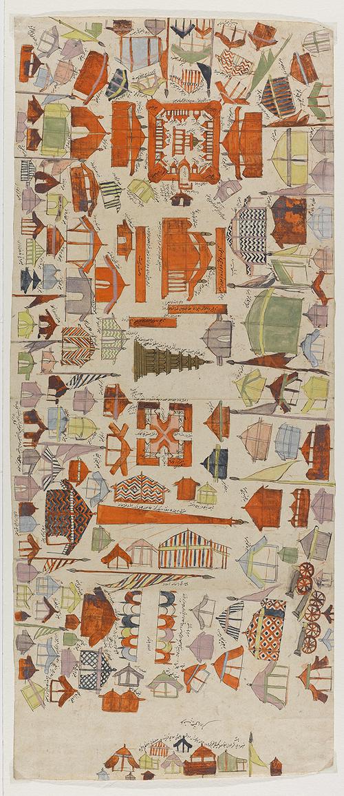
AKM708, Plan of an Encampment, Front
© The Aga Khan Museum
Click on the image to zoom


Plan of an Encampment
- Accession Number:AKM708
- Place:Afghanistan
- Dimensions:28 x 66 cm
- Date:ca. 1800
- Materials and Technique:opaque watercolour, ink and gold on paper
This detailed aerial view of an encampment likely served as a working diagram. Rendered in various colours, many of its structures—including tents and pavilions—are given labels identifying their function and their distance from one another. The entire encampment pivots around a central structure, a “seven-storey gold bangala for the army’s lookout.” Additional structures include a harem, royal diwans, school, library, treasury, and a bazar, among others.
Note: This online resource is reviewed and updated on an ongoing basis. We are committed to improving this information and will revise and update knowledge about this object as it becomes available.